
Spanish Peaks
The Spanish Peaks are the twin mountains you can see for a hundred miles across southern Colorado, rising about 7,000 feet straight up from the plains west of Walsenburg. Ringed by hundreds of giant rock walls that fan out like the spokes of a wheel, they are one of the most striking natural landmarks in the state.
Spanish Peaks near La Veta, CO
Travelers have steered by these peaks for centuries. The Forest Service notes that the Comanche and Ute hold them sacred, and the old name, written as Wahatoya, Huajatolla or Guajatoyah, is usually translated as “breasts of the earth.” West Spanish Peak tops out at 13,623 feet and East Spanish Peak at 12,708 feet, yet from a distance they look almost identical. Unlike the faulted Sangre de Cristo Range next door, they are volcanic stocks: blobs of magma that cooled underground and were later exposed by erosion. The peaks were named a National Natural Landmark in 1976, and Congress set aside the 19,226-acre Spanish Peaks Wilderness in 2000.
The real showstoppers are the dikes. Molten rock squeezed into cracks around the peaks and hardened into vertical walls, and as the softer rock around them wore away, the walls were left standing, some as tall as a building and running for miles across the hills. You can see them right from the car on Highway 12 between La Veta and Cuchara, and they make the whole valley look like the ruins of an ancient fortress. For the best wide-open views of both summits, stop at Lathrop State Park near Walsenburg or pull over along US 160 west of town.
Insider tip: The classic hike is West Peak Trail #1390 from the Cordova Pass Trailhead. From La Veta, take Highway 12 about 16 miles to Cucharas Pass, then turn left on County Road 46 for 6 miles. The Forest Service rates the 2.5-mile trail very difficult and it stops short of the summit, but the views of the Cuchara Valley, Greenhorn Mountain and the Culebra Range are huge. Afternoon thunderstorms are common in summer, so start early, and pair the trip with Fishers Peak State Park near Trinidad.
Photo Gallery
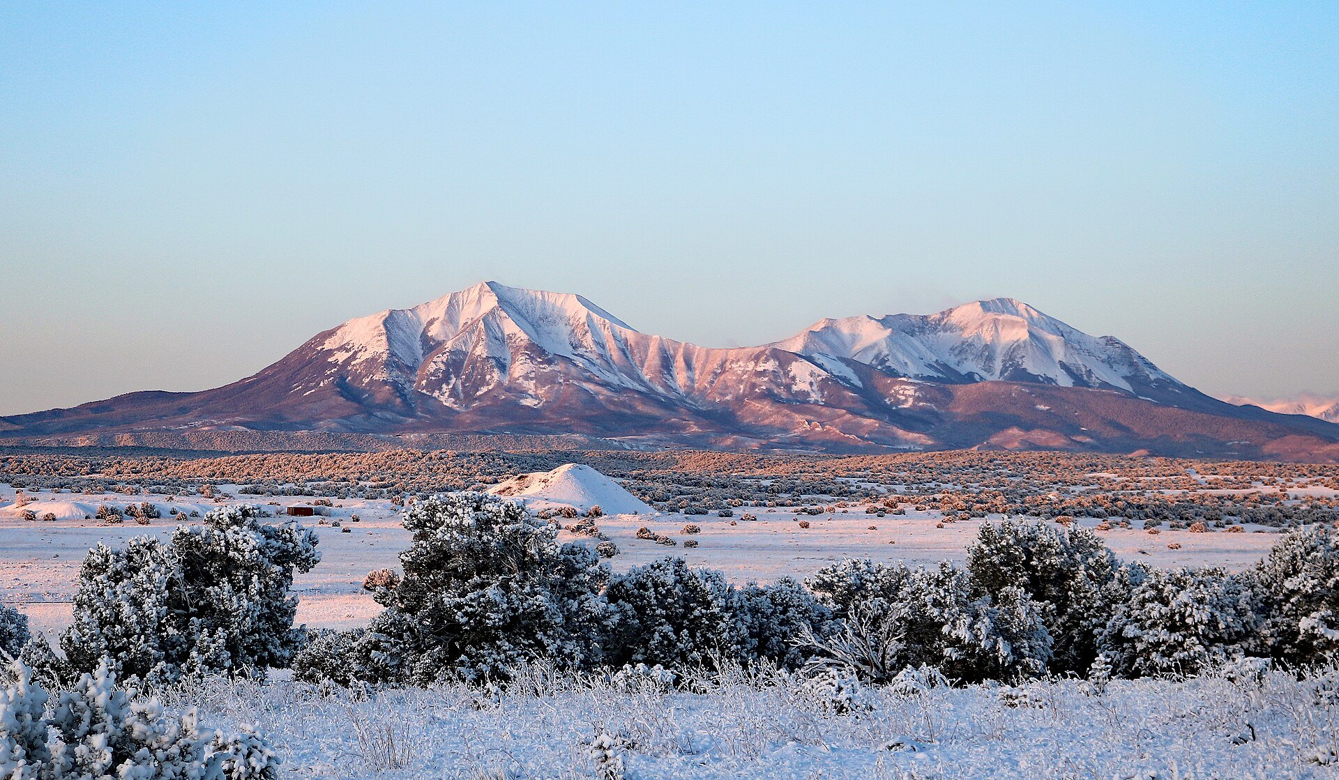
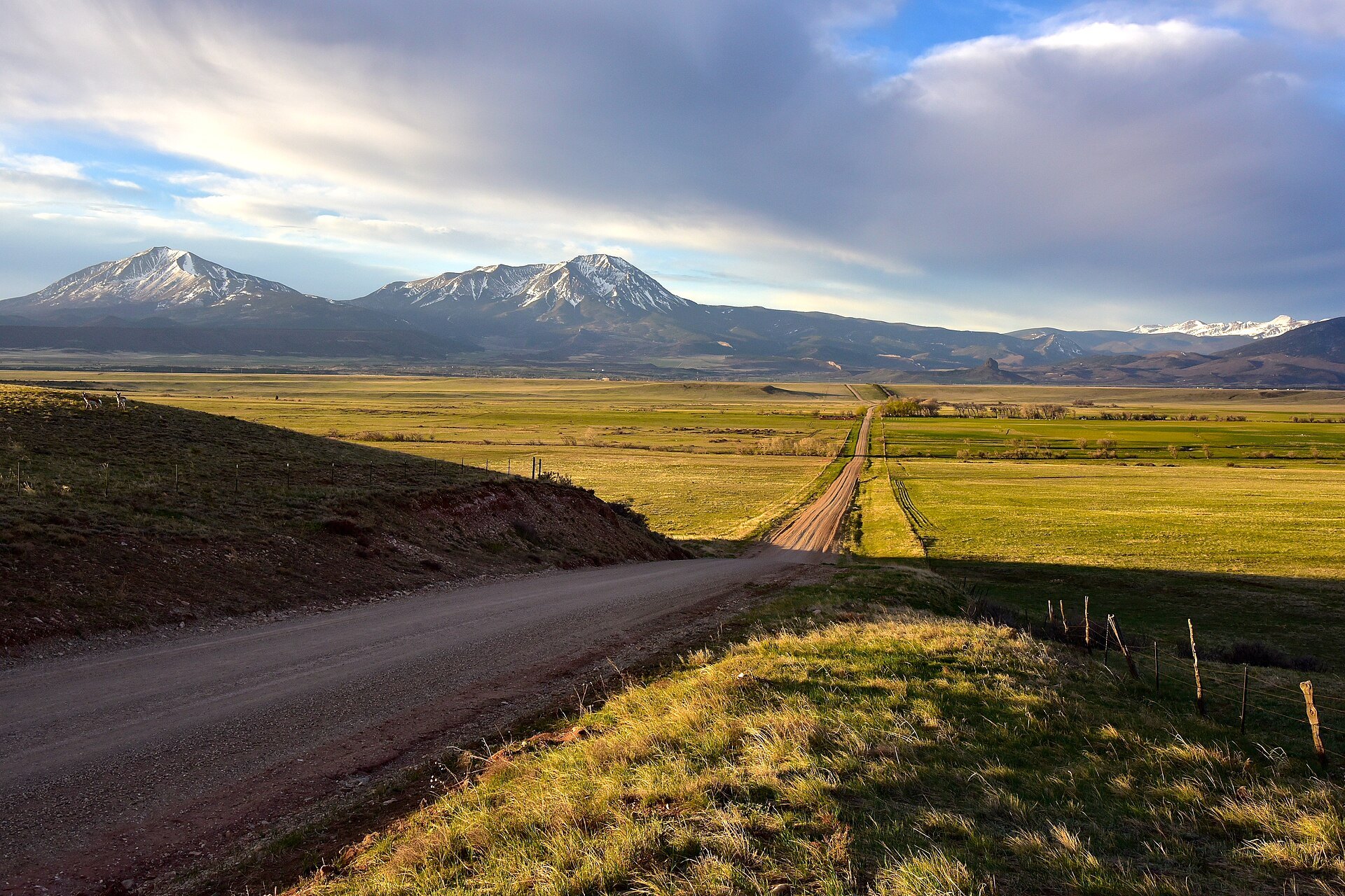
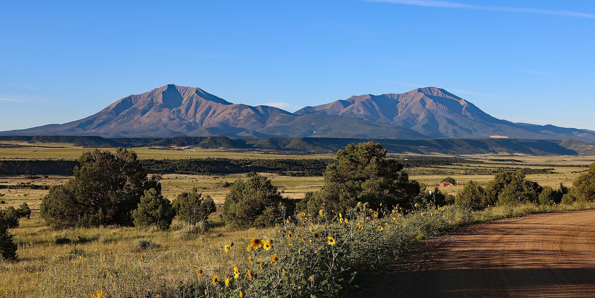
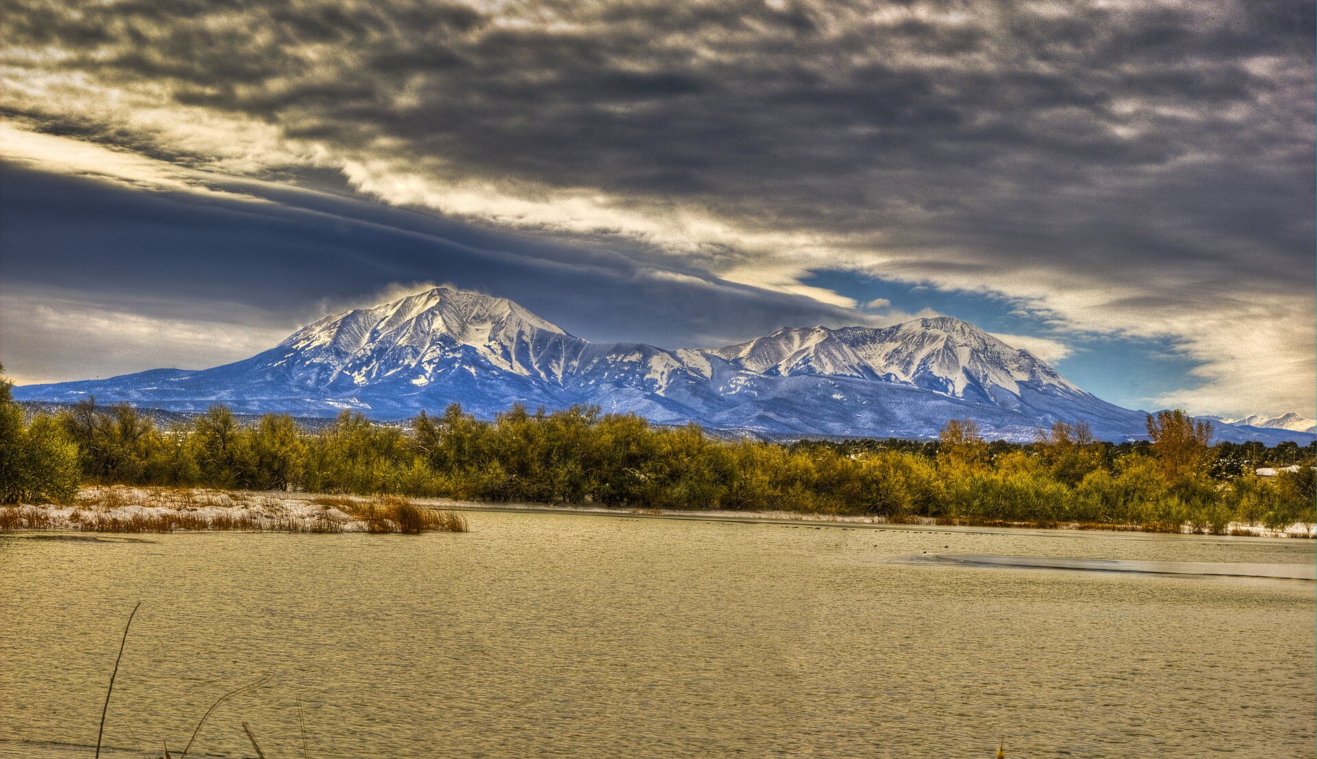
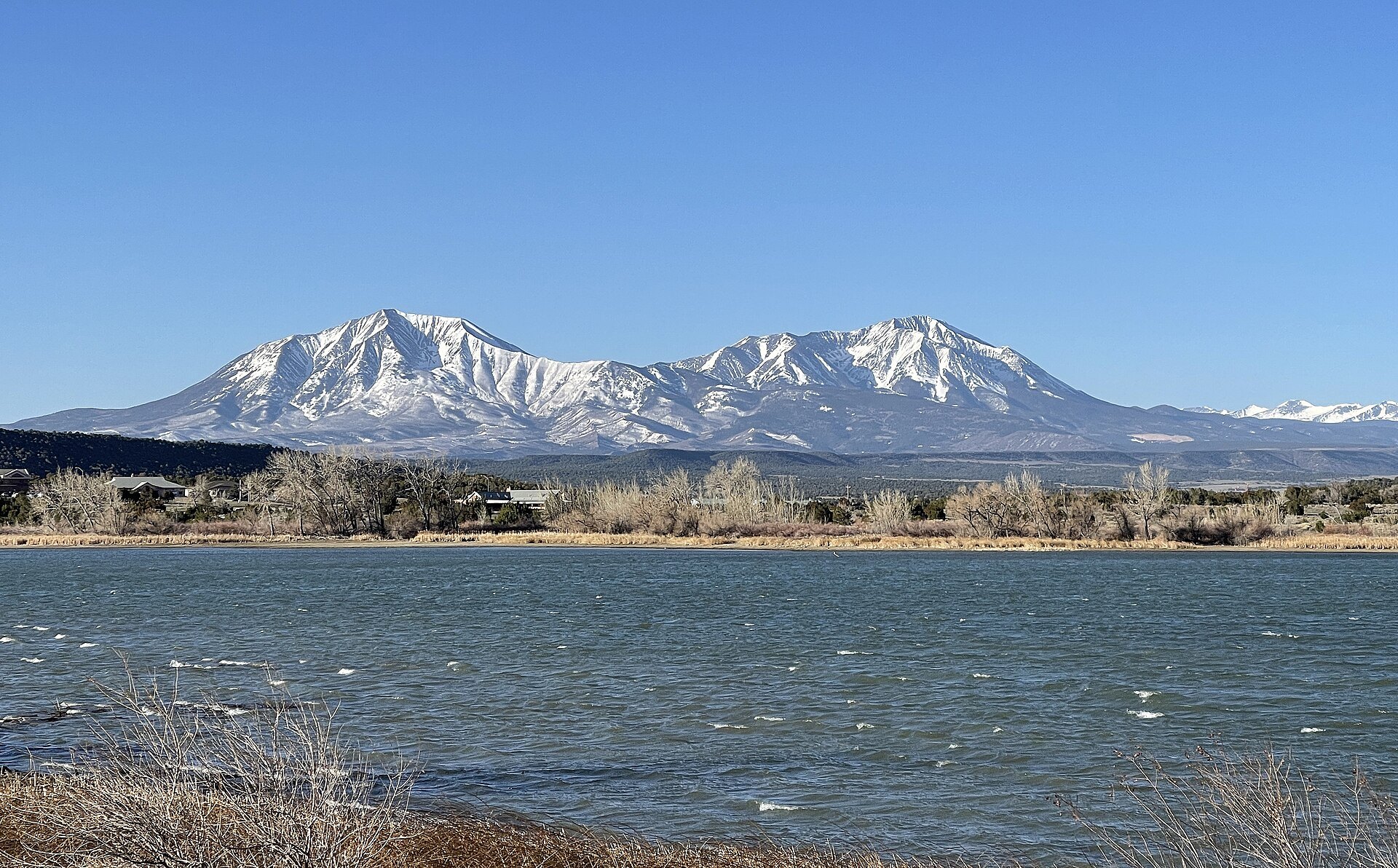
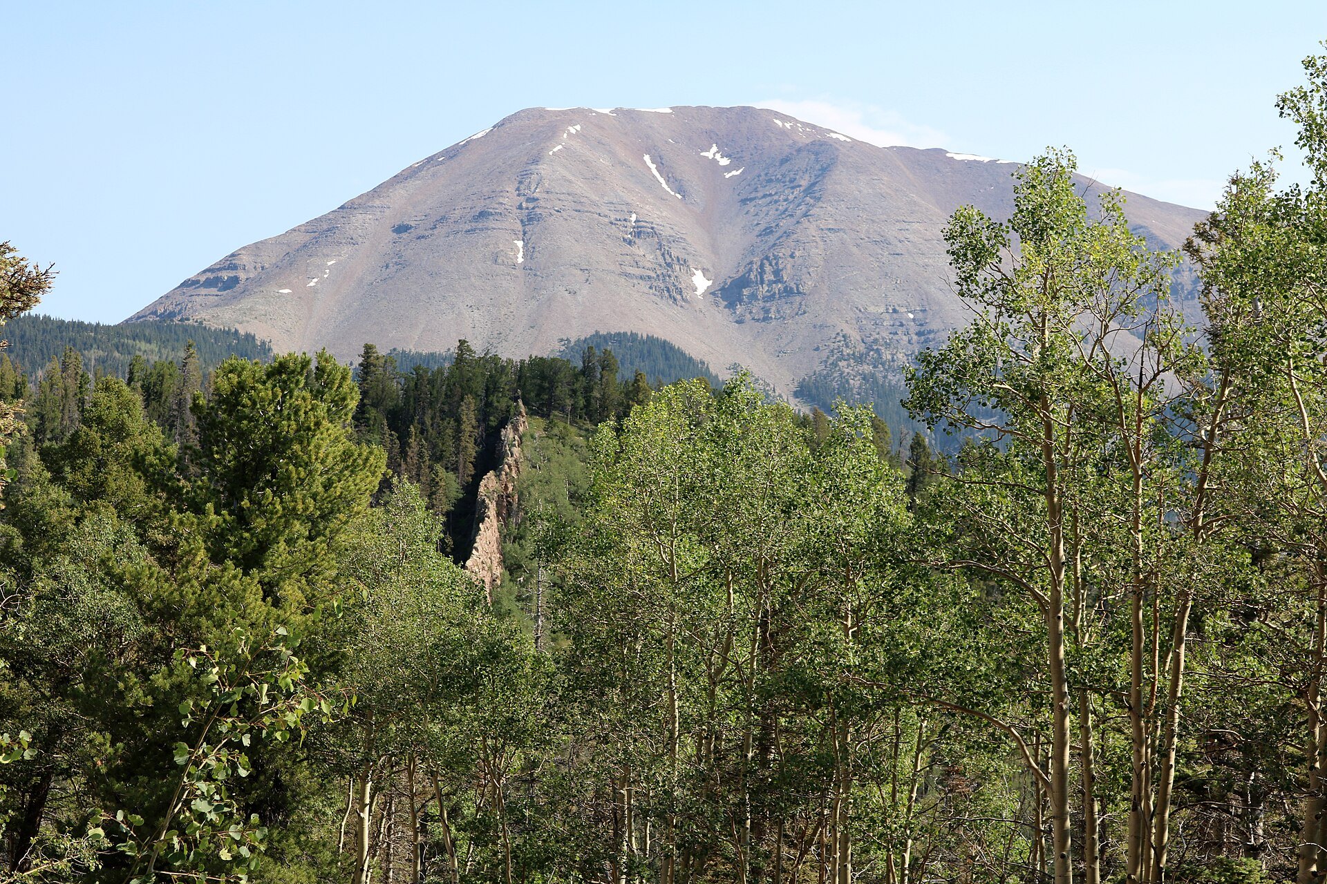
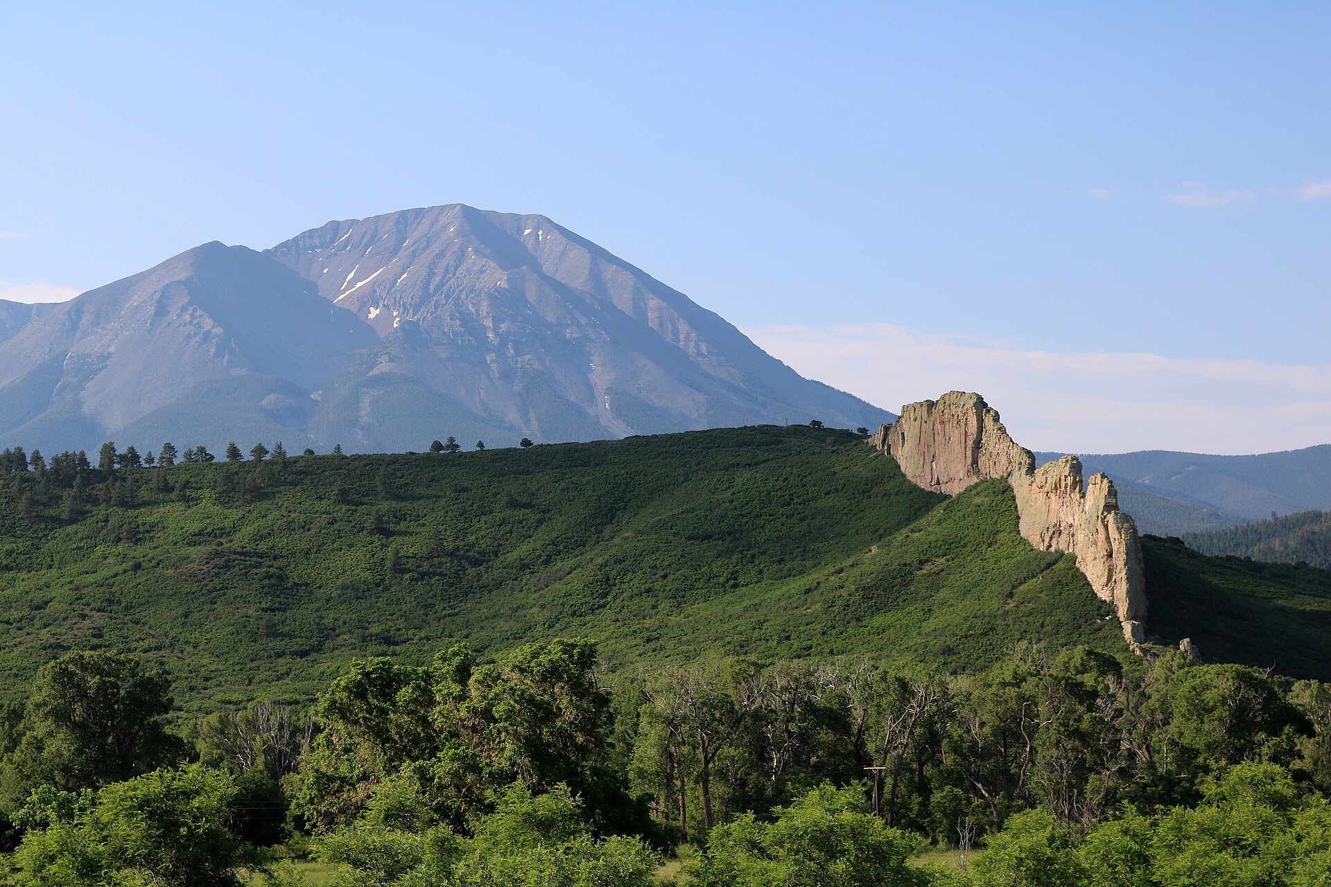


Photo credits: Spanish Peaks at sunrise by Jeffrey Beall (CC BY 4.0); Spanish Peaks La Veta, Colorado [seen from near La Veta] by Larry Lamsa (CC BY 2.0); Spanish Peaks summer morning by Jeffrey Beall (CC BY 4.0); Spanish Peaks in Southern CO by Jeremy Taylor (CC BY 2.0); The Spanish Peaks and Martin Lake [seen from Martin Lake, Lathrop State Park] by Jeffrey Beall (CC BY 4.0); West Spanish Peak by Jeffrey Beall (CC BY 4.0); West Spanish Peak and a dike by Jeffrey Beall (CC BY 4.0); West Spanish Peak from Trail 1390 by Jeffrey Beall (CC BY 4.0); Main Street La Veta, Colorado [Main Street La Veta with West Spanish Peak] by Jeffrey Beall (CC BY 4.0). Images via Wikimedia Commons.
News & Events
Winter brings the Spanish Peaks their brightest snowcaps, and the drive along Highway 12 is a favorite for photographers. Snow can linger at Cordova Pass well into spring, so call the San Carlos Ranger District at 719-269-8500 (Monday through Friday, 8 a.m. to 4:30 p.m.) for conditions before heading up. Wilderness rules apply, so bikes and motor vehicles are not allowed on the trails. See fs.usda.gov for updates.
Frequently Asked Questions
How tall are the Spanish Peaks?
According to the U.S. Forest Service, West Spanish Peak rises to 13,623 feet and East Spanish Peak to 12,708 feet. Both stand about 7,000 feet above the surrounding plains, which is why they are visible from so far away.
What are the walls of rock around the Spanish Peaks?
They are igneous dikes. Magma filled cracks around the peaks and hardened, and erosion later stripped away the softer rock, leaving tall, narrow walls that radiate out from the mountains like spokes. They are one reason the area was named a National Natural Landmark.
Can you hike the Spanish Peaks?
Yes. The Spanish Peaks Wilderness has several trails, including West Peak Trail #1390 from Cordova Pass (2.5 miles, very difficult) and the 12-mile Wahatoya Trail #1304 for hikers and horseback riders. There are no facilities or drinking water, so come prepared.
Where is the best place to see the Spanish Peaks?
Highway 12 between La Veta and Cuchara gives close-up views of the peaks and dikes, while Lathrop State Park and US 160 west of Walsenburg give classic side-by-side views of both summits.
What is near the Spanish Peaks?
Fishers Peak State Park is near Trinidad to the south, and Great Sand Dunes National Park is across La Veta Pass to the west. The small art town of La Veta is the closest base for food and lodging.
The Spanish Peaks Wilderness is managed by the San Carlos Ranger District, 3028 East Main Street, Cañon City, CO 81212. Call (719) 269-8500 or visit fs.usda.gov.