
McInnis Canyons National Conservation Area
McInnis Canyons National Conservation Area is the red rock wonderland hiding just west of Fruita, with soaring sandstone arches, deep side canyons, a dinosaur quarry you can walk past and miles of the Colorado River. It is one of the best places in the state to feel like you’ve wandered into canyon country.
McInnis Canyons near Fruita, CO
Congress created the area on October 24, 2000, first calling it Colorado Canyons National Conservation Area, and renamed it in 2005 for Representative Scott McInnis. The Bureau of Land Management now manages about 123,000 acres here, including the Black Ridge Canyons Wilderness, where seven red rock canyons cut into a long ridge and spires, alcoves, windows and desert varnish decorate the cliffs. The BLM says the area holds the second-highest concentration of natural arches anywhere.
The star attraction is Rattlesnake Arches, a cluster of seven arches tucked below the rim of Rattlesnake Canyon. Getting there is an adventure. From Fruita you drive through Colorado National Monument to 16.5 Road, then 13 miles on the Black Ridge Access Road, where a high-clearance vehicle is mandatory and four-wheel drive is highly recommended. The trail splits about half a mile in: go left for views of the arches from above, or right for the Lower Arches Trail, about 5 miles out and back, which passes beneath them. Hikers without a 4×4 can reach the arches from Pollock Bench Trailhead on Kingsview Road, a long 15-mile round trip.
There’s plenty more. Mountain bikers come from around the world for Mack Ridge and the Kokopelli Loops, the start of the 142-mile Kokopelli Trail to Moab. River runners float the Ruby and Horsethief canyons of the Colorado. At Rabbit Valley (I-70 Exit 2), the free 1.5-mile Trail Through Time loop starts at the Mygatt-Moore Quarry, where paleontologists still dig up bones of Allosaurus, Apatosaurus and other Jurassic giants. Insider tip: Devils Canyon Trailhead on Kingsview Road is the easy, close-to-town way to taste the scenery in an hour or two, and you can finish with peaches and wine in Palisade.
Photo Gallery
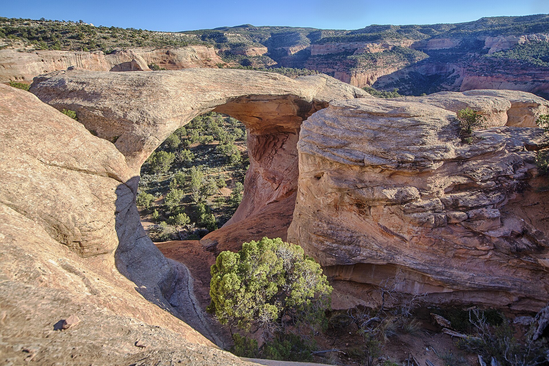
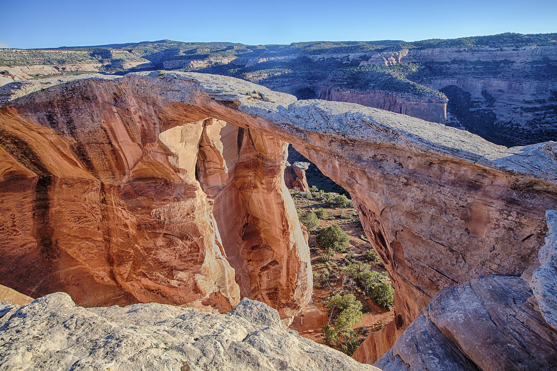


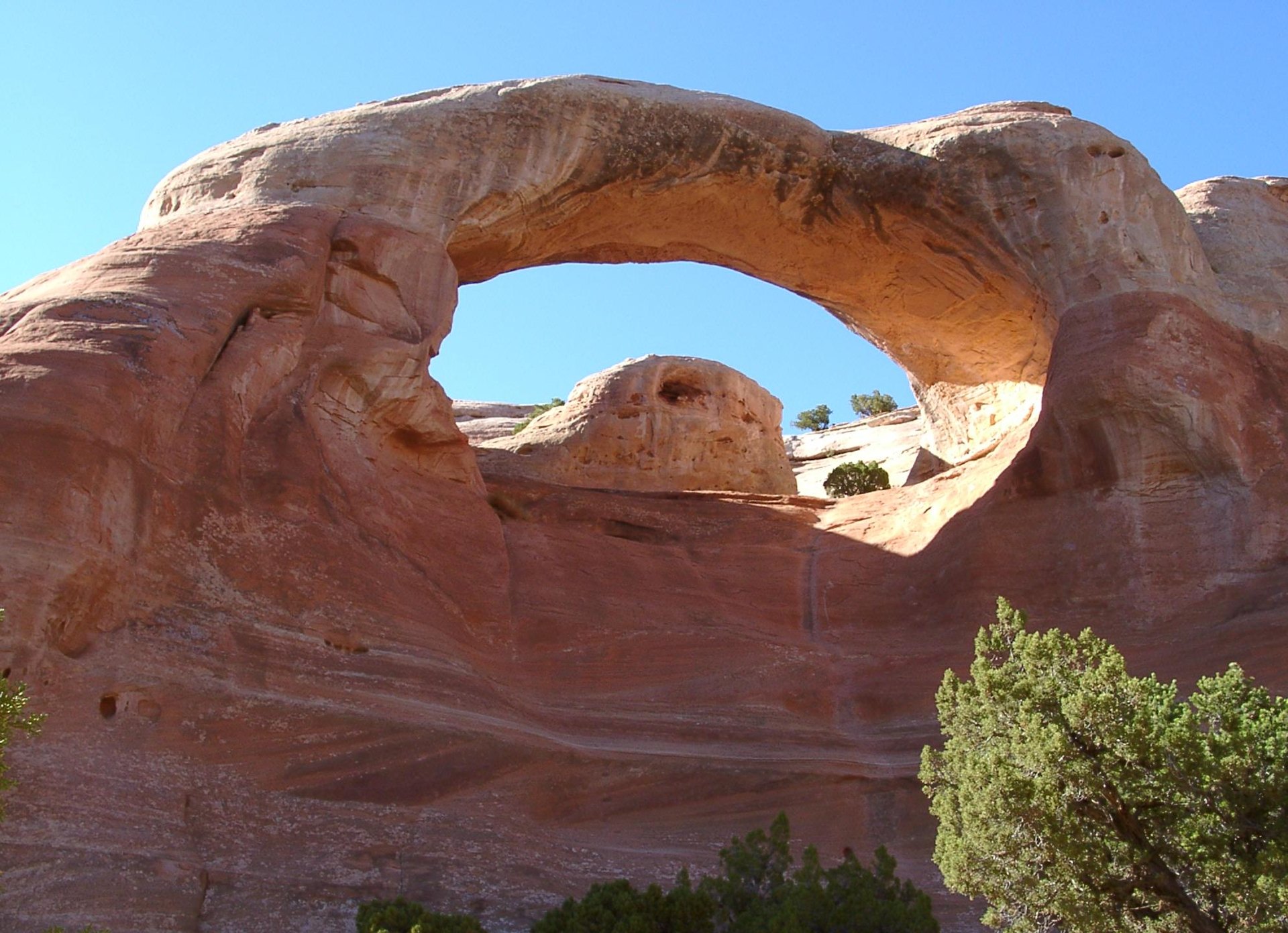
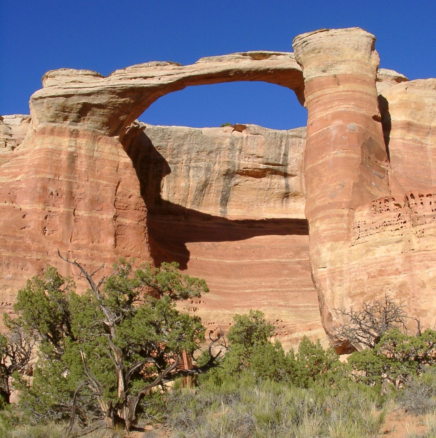


Photo credits: McInnis Canyons National Conservation Area (49758424847) by BLM-Colorado (Public domain); McInnis Canyons National Conservation Area (49757561033) by BLM-Colorado (Public domain); McInnis Canyons National Conservation Area (49757554148) by BLM-Colorado (Public domain); Bridge arch by Pretzelpaws (CC BY-SA 3.0); Cedar tree arch by Pretzelpaws (CC BY-SA 3.0); East rim arch by Pretzelpaws (CC BY-SA 3.0); Rattlesnake Arches (14517225767) by jimmy thomas (CC BY-SA 2.0); Rattlesnake Arches (14700762214) by jimmy thomas (CC BY-SA 2.0); McInnis Canyons National Conservation Area (49758426892) by BLM-Colorado (Public domain). Images via Wikimedia Commons.
News & Events
Right now the Lower Black Ridge Access Road to Rattlesnake Arches is in season (open August 15 through February 14). From February 15 through April 15, motorized travel on the access roads is prohibited, and the Upper road then opens April 15 through August 14. Roads are impassable when wet, and the arches trailhead is day use only. Check blm.gov for current conditions.
Frequently Asked Questions
How do you get to Rattlesnake Arches?
Drive through Colorado National Monument to 16.5 Road, then take the Black Ridge Access Road 13 miles to the trailhead. The BLM says a high-clearance vehicle is mandatory, four-wheel drive is highly recommended and the last 2 miles are very rough. Without a 4×4, you can hike in from Pollock Bench Trailhead, about 15 miles round trip.
How many arches are in Rattlesnake Canyon?
The Rattlesnake Arches area has seven arches. To see all of them, hike the Lower Arches portion of the trail, about 5 miles round trip from the upper trailhead.
Is there a fee to visit McInnis Canyons?
The Trail Through Time at Rabbit Valley has no fee. Overnight river trips through Ruby-Horsethief Canyon need a camping permit from Recreation.gov, and driving to Rattlesnake Arches means passing through Colorado National Monument, which has its own entrance fee. Contact the Grand Junction Field Office with fee questions.
Can you see dinosaur bones at McInnis Canyons?
Yes. The Trail Through Time at Rabbit Valley, off I-70 Exit 2, starts at the active Mygatt-Moore Quarry and passes fossil bones left in place along a 1.5-mile loop. Fossils are protected, so look and photograph but don’t collect.
What is near McInnis Canyons?
Colorado National Monument is right next door, Palisade wine country is about 30 minutes east, and Dinosaur National Monument makes a great add-on for dinosaur fans heading north.
McInnis Canyons National Conservation Area is managed by the BLM Grand Junction Field Office, 2815 H Road, Grand Junction, CO 81506. Call (970) 244-3000 or visit blm.gov.